
The following 18 inter-connecting corridors have been identified as offering particularly important opportunities for new or improved links across the region, to benefit the local community and environment.
Connecting the Dandenong Ranges to the Dandenong Creek Corridor
Blind Creek runs from the base of the Dandenong Ranges National Park at Ferntree Gully, through Ferntree Gully, Boronia, Wantirna South and Scoresby to Glen Waverley where it meets the Dandenong Creek. It has disjointed patches or strips of significant habitat along its length including some very special places such as Blind Creek Billabong.
A shared path follows the path of the creek between the Belgrave Railway Line at Boronia all the way to Dandenong Creek. The creek is generally surrounded by residential areas, but also passes through the Knox Central principle activity centre at Wantirna South and between landfill sites in Wantirna South along the Dandenong Creek corridor.
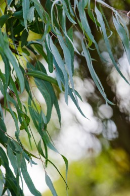
This corridor has environmental, social and recreational values.
Attributes
The recreational and social features found within or near to the corridor include:
- Knox Activity Centre
- Mountain Gate Activity Centre
- Dandenong Valley Parklands
- Chesterfield Park
- Boronia Activity Centre
The environmental and cultural features found within or near this corridor include:
- 4 endangered vegetation communities
- 5 recorded threatened flora species
- 27 recorded threatened fauna species
- 4 significant Aboriginal Cultural Heritage Sites
- 1 area listed on the Register of the National Estate
- Approximately 2ha of significant waterbodies
Opportinities (Gaps)
- Lewis Park Master plan
- Westfield Knox Car park cuts off corridor, Blind Creek going underground through this area.
- Improve pedestrian amenity adjacent to Westfield Knox and Stud Road.
- Extend trail through Forrest Road Drain.
The Boggy Creek Corridor begins at the Langwarrin Flora and Fauna Reserve, runs through private property until it reaches North Road where the surrounding condition is suburban, then passes through a range of quarries before entering The Pines Flora and Fauna Reserve, passing under the Mornington Peninsula Freeway and flowing into Eel Race Drain. The corridor has a range of adjacent land-uses, including residential, industrial, rural, extractive industries, and flora and fauna reserves. As such, the corridor provides a range of opportunities to improve ecological and public amenity outcomes.
Water flows into Boggy Creek from both the Langwarrin and Pines Flora and Fauna Reserves, through Carrum Downs to the Seaford Wetlands, then into Eel Race Drain and Kananook Creek before reaching Port Phillip Bay. The creek has a known population of the Dwarf Galaxias, a threatened fish species.
The Langwarrin and Pines Flora and Fauna Reserves previously supported Southern Brown Bandicoots.
This corridor has environmental, social, recreational and cultural values.
Attributes
The recreational and social features found within or near to the corridor include:
- The Pines Flora and Fauna Reserve
- Langwarrin Flora and Fauna Reserve
- Karingal Hub Activity Centre
- Peninsula Country Golf Club
- Centenary Park Golf Course
- Monash University Peninsula Campus
- Victoria Royal Botanic Gardens Cranbourne
- Edithvale – Seaford Wetlands
- Langwarrin Landfill
The environmental and cultural features found within or near this corridor include:
- endangered vegetation communities
- threatened flora species
- threatened fauna species
- significant Aboriginal Cultural Heritage Sites
- areas listed on the Register of the National Estate
- significant waterbodies
Opportunities (Gaps)
- Build a path network upstream from McClelland Road, initially focusing on sections passing through residential areas.
- Huge opportunities for both ecological and community amenity outcomes as extractive industries stop operating along Boggy Creek.
- Strengthen connection from Boggy Creek into Eel Race Drain and the Seaford Wetlands.
This corridor links two significant parks – the Dandenong Ranges National Park and Lysterfield Park – to the Dandenong Creek. These parks provide opportunities for many recreational pursuits and contain significant vegetation for wildlife. Lysterfield Park and Churchill National Park are great assets so close to the city both in terms of ecology value and public amenity. Creating legible walking routes through the parks is key to providing the best possible public amenity. By improving the access to these valuable assets, each of them can be accessed and utilised more frequently and by more people.
The western end of the corridor connects through to Dandenong Creek at Brady Road. In the north-west the corridor connects through Birdsland Reserve to Belgrave Station.
Attributes
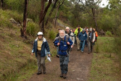
The recreational and social features found within or near to the corridor include:
- Dandenong Creek
- Birds Land Reserve
- Lysterfield Park
- Churchill National Park
- Churchill Park Golf Club
- Dandenong Police Paddocks Reserve
- Sydney Pargeter Rec Area
The environmental and cultural features found within or near this corridor include:
- endangered vegetation communities
- threatened flora species
- threatened fauna species
- significant Aboriginal Cultural Heritage Sites
Opportunities (Gaps)
- Great opportunity to create connected walking/cycling trails through Lysterfield National Park.
- Continue through Belgrave and link the bushland north of Belgrave.
Connecting the Dandenong Ranges along Dandenong Creek to Patterson River and Port Phillip Bay
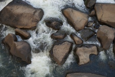
This corridor follows Dandenong Creek and forms the central spine of the Living Links network, to which many other corridors connect. The creek flows south-west from Olinda, through Glen Waverley and Dandenong, then into the Patterson River at Bangholme. From there the water flows into Port Philip Bay.
This corridor contains significant open space areas that provide recreational and social benefits. The Dandenong Creek Trail follows the creek all the way from Kilsyth to Carrum on Port Philip Bay, and provides important links to other regional trails. There are areas of industry, farming, and residential use abutting the creek corridor as well as significant stormwater treatment wetlands.
The corridor supports a range of significant flora and fauna species. It is important for daily and seasonal movements of birds and insects (particularly waterbirds and parrots), as well as for pollen and plant propagules that the fauna may transport.
Much restoration work has been undertaken to improve the amenity and habitat connectivity of this corridor. Revegetation is playing an important role in reducing the extensive fragmentation of habitat that has occurred historically.
This corridor has environmental, social, recreational and cultural values.
Attributes
The recreational and social features found within or near to the corridor include:
- Dandenong Valley Parklands
- Morack Public Golf Course
- Bayswater Activity Centre
- Dandenong Ranges National Park
- Chesterfield Farm
- Dandenong Park
- Dandenong Activity Centre
- Tirhatuan Park
- Melbourne Water Rec Area
- Churchill National Park
- Dandenong Wetlands
- Falkner Reserve
- Police Paddocks Reserve
- Dandenong Park
- Thomas P Caroll Reserve
- Robert Booth Reserve
- Greaves Reserve
The environmental and cultural features found within or near this corridor include:
- at least 14 endangered vegetation communities
- at least 9 recorded threatened flora species
- at least 33 recorded threatened fauna species
- at least 27 significant Aboriginal Cultural Heritage Sites
- at least 13 areas listed on the Register of the National Estate
- approximately 42ha of significant waterbodies
Opportunities (Gaps)
- Improve connection to cycling paths in Dandenong Ranges National Park.
- Large areas for revegetation works along the corridor.
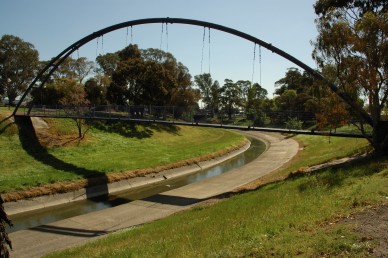
- Concrete channel downstream from of Clow Street in Dandenong to the Dandenong Bypass, opportunities for daylighting of the creek.
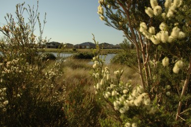
This corridor connects Karkarook Park in Oakleigh South through to Tatterson Bushland, then follows the Dandenong Bypass Trail until the trail ends at the South Gippsland Highway in Dandenong South. In the north-east the corridor follows the “Sandbelt Parklands” or “Chain of Parks” funded through the Suburban Parks Program of the Victorian Government.
Currently there is an off-road path on the northern side of the Dingley Bypass and Westall Road, travelling all the way to The Dandenong Creek Trail. The Mordialloc Freeway Bypass will be key to improving the pedestrian and cycling amenity within the area.
This corridor links up with the Mordialloc Freeway Bypass corridor, Yarraman and Mile Creek corridor and Dandenong Creek corridor. It also has the potential to link with Eumemmerring Creek Corridor.
Attributes
- Tatterson Bushland and open space
- Alex Wilkie Bushland
- Coomoora Bushland
- Braeside Park
- Keysborough Golf Club
- Spring Valley Park
- Heatherton Park
- Moorabin Airport
- Capital Golf Course
- Karakook Park
Opportunities (Gaps)
- Create trail and ecological connection from Dandenong South Trail to Eumemmerring Creek corridor.
- Opportunities to use the Mordialloc Freeway Bypass to strengthen the corridor ecologically and also from a pedestrian/cyclist perspective
This corridor follows the Djerring Trail that runs along the Cranbourne and Pakenham train line, following the recently completed level crossing removal works and newly created open space.
This corridor fills a connectivity gap in the Living Links study area to the north east. It connects to a number of established parks, sports fields, activity centres and transport nodes.
Attributes
The recreational and social features found within or near to the corridor include:
- Monash University Caulfield Campus
- Monash University Clayton Campus
- Caulfield Racecourse
- Boyd Park
- Huntingdale Golf Course
- Springvale Reserve
- Sandown Race Course
- Ross Reserve
- Mile Creek
Opportunities (Gaps)
- Connects the two Monash University campuses.
- Creates a recreational and ecological link between parks, reserves, transport and schools.
Connecting Cranbourne Royal Botanic Gardens to Eumemmerring Corridor.
This corridor follows the Eastern Contour Drain from the Royal Botanic Gardens at Cranbourne to the Eumemmerring Creek, connecting the Gardens with the wider corridor network. It passes through agricultural, suburban and industrial land. Throughout the corridor there are many large remnant River Red Gums.
Attributes
The recreational and social features found within or near to the corridor include:
- Royal Botanic Gardens
- Settlers Run Golf Course
- Bunurong Memorial Park
- Ranfurlie Golf Club
- Ambrosia Wetlands
- Sandhurst Golf Club
- Eumemmerring Creek
Opportunities (Gaps)
- Corridor runs through large private agricultural holdings. Opportunity to work with private landholders to improve ecological outcomes.
- There is a large amount of space alongside the drain.
Connecting Lysterfield Park along Eumemmering Creek to Patterson River
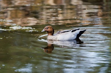
The corridor follows the Eumemmering Creek from Lysterfield Park car park in Narre Warren North, to Dandenong South, then along the Hallam Main Drain to Bangholme where it joins the Patterson River Corridor.
Many Living Links projects have occurred along the Eumemmering Creek. These have involved preservation of significant remnant vegetation such as river red gums, revegetation works and removal and control of weeds. The next steps are to join up existing trails and shared paths to create a continuous biodiversity corridor from Lysterfield Park to Patterson River.
Attributes
The recreational and social features found within or near to the corridor include:
- Endeavour Hills Activity Centre
- Melbourne Water Retarding Basin
- Eumemmerring Park
- Gunns Road Reserve
- Hallam Bypass Trail
- Frog Hollow Reseve
- Narre Warren North Reserve
- Lysterfield Park
The environmental and cultural features found within or near this corridor include:
- at least 9 endangered vegetation communities
- at least 4 recorded threatened flora species
- at least 1 recorded threatened fauna species
- at least 3 significant Aboriginal Cultural Heritage Sites
- at least 4 areas listed on the Register of the National Estate
- at least 13ha of significant waterbodies
Opportunities (Gaps)
- Off-road path connection to Lysterfield National Park.
- Large opportunity for re-vegetation works.
- Opportunities for the expansion of the creek corridor as the land use upstream of Hallam North Road changes from residential to agricultural. This will be key as increased density in the area will put greater pressure on the creek ecologically and in the terms of population it will service.
- Increase vegetation cover and public amenity as the corridor passes through Dandenong South industrial estate.
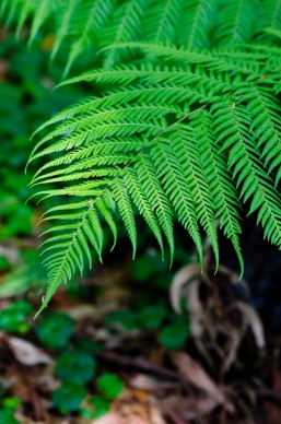
This creek corridor connects the Dandenong Ranges National Park at Upper Ferntree Gully to Lysterfield Park at Belgrave Heights via Ferny Creek and its tributaries, then on to the Dandenong Creek Corridor at Rowville via Monbulk Creek. The corridor splits in two at Waterford Valley Golf Club, one branch following Ferny Creek towards Upper Ferntree Gully Station, and the other moving through private land towards Belgrave Station.
There is an extensive shared path network that stretches from Upper Ferntree Gully to Stud Rd. This is planned to be extended to Dandenong Creek.
The western third of the corridor is located in the Scoresby-Knoxfield-Rowville employment precinct. Further upstream of Ferny Creek, adjacent land use is generally residential, while on the Monbulk Creek the adjacent land use quickly becomes rural.
This corridor has environmental, social, cultural and recreational values.
Attributes
The recreational and social features found within or near to the corridor include:
- Mountain Gate Activity Centre
- Dandenong Valley Parklands
- Caribbean Gardens & Market
- Stamford Park
- Waterford Valley Golf Course
- Glenfern Valley Bushlands
- Birds Land Reserve
- Lysterfield Park
- Dandenong Ranges National Park
- Upper Ferntree Gully Station
The environmental and cultural features found within or near this corridor include:
- at least10 endangered vegetation communities
- at least 3 recorded threatened flora species
- at least 14 recorded threatened fauna species
- at least 9 significant Aboriginal Cultural Heritage Sites
- at least 1 area listed on the Register of the National Estate
- approximately 27ha of significant waterbodies
Opportunities (Gaps)
- Link through to Ferntree Gully Quarry, Train station and 1000 steps.
- Create connection from Ferny Creek Trail to Ringwood-Belgrave Rail Trail.
- Large section of the corridor is private land. Work with landholders to improve ecological outcomes.
This corridor connects new and existing communities along Hallam Valley, with links to significant activity centres. It runs from Clyde North, through the Hallam Valley into Eumemmerring Creek Corridor at Dandenong South.
The Hallam Valley Trail that runs through the majority of this corridor is in excellent condition and is well utilised. The corridor links parts of City of Casey within the urban growth zone, especially around Berwick Waters, Cranbourne North and Clyde North. This area is undergoing significant development and population growth.
Several threatened species or Ecological Vegetation Communities listed under the federal Environment Protection and Biodiversity Conservation Act 1999 occur along the corridor, including Dwarf Galaxias, Seasonal Herbaceous Wetlands and migratory birds that utilise the wetland and drain habitats.
This corridor has environmental, recreational and cultural values.
Attributes
The recreational and social features found within or near to the corridor include:
- Beaconsfield Flora and Fauna Reserve
- Cardinia Creek
- Melbourne Water Troups Creek Wetlands
- Sweeney Reserve
- Fountain Gate Activity Centre Berwick Activity Centre
- Berwick Springs
- Berwick Station
- Narre Warren Station
- Hallam Station
The environmental and cultural features found within or near this corridor include:
- endangered vegetation communities
- recorded threatened flora species
- significant Aboriginal Cultural Heritage Sites
- areas listed on the Register of the National Estate
- significant waterbodies
Opportunities (Gaps)
- Opportunity for extensive revegetation work throughout Hallam Valley with a specific focus on riparian ecologies. The area from Dandenong Creek to Dandenong Valley Highway is particularly degraded.
- Create off-road path to link with Eumemmerring Creek Trail to the north.
- Create off-road path along Eumemmerring Creek linking Hallam Valley Trail to Dandenong Creek Trail.
- Create off-road path connecting Narre Warren Station to Hallam Valley Trail.
- Create pedestrian and ecological link to River Red Gum Reserve.
Connecting Boggy Creek Corridor through Eel Race Drain to Port Phillip Bay
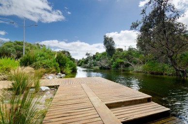
Kananook Creek is one of three tributaries in the Living Links area that flow directly out into Port Phillip Bay. It was a natural outlet of the former Carrum Carrum Swamp, which lay behind the coastal dunes from Mordialloc to Frankston.
Running parallel to the coastline, the creek connects Seaford Wetlands to the Port Philip Bay Foreshore at Frankston.
Greatly disturbed by past development, today Kananook Creek is in much better condition and is home to many indigenous plants and animals. It is one of Frankston’s most beautiful natural environments, providing a unique and picturesque place for people to commune with nature in the midst of the urban landscape.
Kananook Creek was an important source of fish and eels for the local Bunurong tribe. There is still evidence of their activities along the banks of Kananook Creek.
This corridor has environmental, social, recreational and cultural values.
Attributes
The recreational and social features found within or near to the corridor include:
- Keast Park
- Peninsula Kingswood Golf Club
- Kananook Creek Reserve
- Seaford North Reserve
- Edithvale Seaford Wetlands
- Frankston Station
The environmental and cultural features found within or near this corridor include:
- endangered vegetation communities
- threatened flora species
- threatened fauna species
- significant Aboriginal Cultural Heritage Sites
Opportunities (Gaps)
- Upgrade path network to make it more accessible.
- Large opportunities for re-vegetation works upstream of Eel Race Road.
- Interface with Patterson Lakes could be improved for greater ecological outcomes.
Connecting the Edithvale Wetlands to Mordialloc Creek and Patterson River via the Long Beach Trail
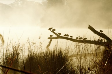
Long Beach Trail is an existing shared path network that runs through an open space and drainage easement between Mordialloc Creek in the north and Patterson River in the south. A number of important natural features adjoin this easement, including the internationally recognised Edithvale Wetlands as well as Yammerbook Wetlands, Mordialloc Creek Reserve, Wannarkladdin Wetland and the Edithvale Common.
Much work to enhance the natural values of the corridor have been carried out by City of Kingston and Melbourne Water, with help from local schools, community groups and members of the public. There are opportunities for further work in various sections along the trail, such as improving path connectivity between residents and amenities and revegetation and weed control works to improve habitat for local fauna and provide a vegetation buffer for Edithvale Wetlands.
Attributes
The recreational and social features found within or near to the corridor include:
- Edithvale-Seaford Wetlands Environmental Area
- Yammerbook Nature Reserve
- Rossdale Golf Club
- Patterson River Country Club
- National Water Sports Centre
Opportunities (Gaps)
- Potential for stakeholders to investigate purchasing of private
land on Thames Promenade to expand the corridor. - Improve intersections between roads and corridor.
- Extensive revegetation works.
- Improve connections back to train station to improve accessibility to the wetland corridor.
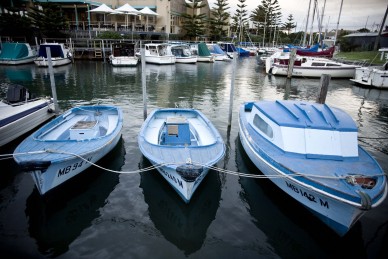
This corridor connects between the Dandenong Creek Corridor at Bangholme and Port Philip Bay at Mordialloc via the Mordialloc Creek. It also connects between a number of other Living Links corridors including the Eummemmering Creek, Patterson River and the Mordialloc Freeway Bypass.
Much work has been done over the years by council and the community on this corridor. The section between Dandenong Creek and Springvale Road requires particular attention.
This corridor has environmental, recreational and cultural values.
Attributes
The recreational and social features found within or near to the corridor include:
- Mordialloc Activity Centre
- G Woods Reserve
- Jack Grut Reserve
- Browns Reserve
- Yammerbook Nature Reserve
- Braeside Park
- Keysborough Golf Club
- Keysborough Linear Reserve
- Edithvale Wetlands
- Tatterson Bushland and open space
The environmental and cultural features found within or near this corridor include:
- endangered vegetation communities
- threatened flora species
- threatened fauna species
- significant Aboriginal Cultural Heritage Sites
- areas listed on the Register of the National Estate
- significant waterbodies
Opportunities (Gaps)
- Highly degraded upstream of Boundary Road, with the exception
South of Waterways. - Options for naturalising the waterway and extensive revegetation works.
- Off-road path upstream of Springvale Road.
- Numerous drains and waterways drain into the creek. Upgrading of these spaces would further strengthen the network and improve health of the waterway.
The Mordialloc Freeway Bypass will connect the Mornington Peninsula Freeway at Springvale Road to the Dingley Bypass. The project comprises a 9 kilometre freeway with bridges over wetland areas, several grade- separated interchanges and a cycling and walking path.
Attributes
The recreational and social features found within or near to the corridor include:
• Braeside Park
• Mordialloc Activity Centre
• Moorabin Airport
• Mordialloc Creek
• Keysborough Golf Club
Opportunities (Gaps)
- Potential to leverage investment into adjoining open spaces.
- Opportunities arise to link into existing and proposed shared bike paths, creating a strong connection to other corridors to the north and south.
Connecting the Dandenong Creek, Long Beach Trail and Eumemmering Creek Corridors to Port Phillip Bay via the Patterson River
This corridor follows Patterson River from Bangholme to Port Philip Bay at Carrum. It provides an important link between a number of Living Links corridors, including the Dandenong Creek, Eumemmerring Creek, Mordialloc Creek and Port Philip Bay corridors.
The Patterson River area was originally Carrum Carrum Swamplands, which extended from Mordialloc to Frankston behind a broad coastal sand ridge. In 1879, public works were conducted to cut through the sand ridge to drain the swamp. This cut was referred to as the Patterson’s Drain or River. Patterson River now consists of a thriving canal system within the Patterson Lakes residential area. There are facilities for boats, riverside picnics and it also contains the National Water Sports Centre. This area is managed in partnership by Parks Victoria, Melbourne Water and City of Kingston.
This corridor has environmental, recreational and cultural values.
Attributes
The recreational and social features found within or near to the corridor include:
- Patterson River Golf Club
- Cornish College
- Wannarkladdin Wetlands
- Bicentennial Park
- National Water Sports Centre
- Melbourne Water owned land
The environmental and cultural features found within or near this corridor include:
- endangered vegetation communities
- threatened fauna species
- significant Aboriginal Cultural Heritage Sites
- significant waterbodies
Opportunities (Gaps)
- Extensive revegetation works along the river banks with a particular focus placed upstream of the harbour.
- Downstream of the harbour, works should be undertaken to minimise and negative environmental effects from being a highly trafficked area.
Connecting Frankston Foreshore along Port Phillip Bay to St Kilda and Albert Park
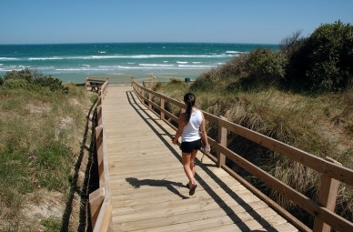
This corridor is centred on the Port Philip Bay foreshore between St Kilda and Frankston, providing a connection between the Mornington Peninsula and Melbourne.
The Bay Trail provides an off-road pedestrian and cycling route north of Mordialloc Pier. South of the pier, there is no off-road path until Patterson River. South of Patterson River there are small sections of off-road path but this network lacks legibility.
Indigenous vegetation provides protection from cold salty sprays during winter months and makes a beautiful backdrop for beach users during summer. Councils are committed to providing a shared cycling and walking path along the foreshore to connect with their neighbouring municipalities.
This corridor has environmental, social, cultural and recreational values.
Attributes
The recreational and social features found within or near to the corridor include:
- Royal Melbourne Golf Club
- Braeside Park
- Acland Street Activity Centre
- Fitzroy Street Activity Centre
- Church Street Activity Centre
- Hampton Street Activity Centre
- Sandringham Village Activity Centre
- Mordialloc Activity Centre
- Chelsea Activity Centre
- Edithvale-Seaford Wetlands
- Peninsula Kingswood Country Golf Club
The environmental and cultural features found within or near this corridor include:
- 18 endangered vegetation communities
- 13 recorded threatened flora species
- 51 recorded threatened fauna species
- 22 significant Aboriginal Cultural Heritage Sites
- 84 areas listed on the Register of the National Estate
- Approximately 30ha of significant waterbodies
Opportunities (Gaps)
- Complete gaps in off-road trail along the entirety of corridor.
This corridor follows Troups Creek from Harkaway Road in the east to the Hallam Valley corridor in the south. It passes through predominantly residential areas, although the north-eastern section passes through rural areas. There are portions of remnant vegetation along the corridor as well as a range of sports fields, playgrounds and parks. There are small sections of off-road paths in the southern section of the corridor but no path network upstream of Kalora Park.
Attributes
The recreational and social features found within or near to the corridor include:
- Prospect Hill Retarding Basin
- Narre Warren North Melbourne Water
- Lysterfield Park
- Hallam Main Drain
- Hallam Train Station
- Narre Warren Train Station
Opportunities (Gaps)
- Create a connection to Lysterfield Park and the Eumemmerring Creek Corridor, by locating a path along the power line easement north from Troups Creek Retarding Basin.
- The corridor could be linked to remnant vegetation surrounding Cardinia Creek in the future.
This corridor follows Mile Creek and Yarraman Creek from their respective headwaters in Springvale and Noble Park North to the Dandenong Creek Corridor.
Mile Creek is a concreted drain from Westall Road until Chandler Road – this section provides low ecological and/or public amenity. The corridor’s proximity to Djerring Trail provides opportunities to improve the quality and patronage of the corridor.
Council, Melbourne Water and the community have been involved in a range of restoration projects along this corridor to improve the amenity and habitat connectivity. Further opportunities exist for further restoration along this corridor, particularly through daylighting of Mile Creek.
Attributes
The recreational and social features found within or near to the corridor include:
- Sandown Racecourse and Entertainment Centre
- Greaves Reserve
- Fotheringham Reserve
- Noble Park Activity Centre
- Springvale Activity Centre
- Ross Reserve
The environmental and cultural features found within or near this corridor include:
- endangered vegetation communities
- threatened flora species
- threatened fauna species
- significant Aboriginal Cultural Heritage Sites
- significant waterbodies
Opportunities (Gaps)
- Mile Creek is in concrete channel from Chandler Road to Corrigan Road, providing opportunities for daylighting that will provide ecological and public amenity outcomes.
- Link with Djerring Trail Noble Park.
- A drain continues north near the headwater of Mile Creek, connecting to the Monash University Clayton Campus. A large amount of investment would be needed in order to make this connection of value ecologically and to the public. The unnamed drain runs through industrial estates and is currently a concrete channel.


